3D Model Styling
When a GeoJSON point layer uses model visualisation mode, each point is replaced with a 3D glTF model. This is useful for placing trees, buildings, vehicles, or other objects at specific locations.
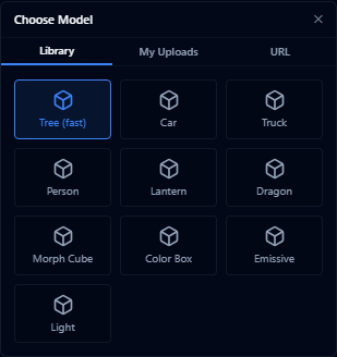
Model source
| Source | Description |
|---|---|
| Preset library | Choose from built-in 3D models |
| URL | Load a model from a direct URL |
| Uploaded file | Use a model file uploaded with the layer |
| By attribute | Assign different models to different attribute values |
Fast tree rendering
The preset library includes Tree (fast) for dense tree or vegetation point layers. This preset uses lightweight tree impostors instead of loading a full glTF model per feature, so it is better suited to hundreds or thousands of trees.
When the tree preset is selected, the style panel shows a Tree impostor section:

| Setting | Description |
|---|---|
| Stylized 2D | Uses the generated stylized tree texture |
| Realistic 2D | Uses a selected tree texture on a lightweight plane |
| Cross-plane 3D | Uses crossed planes for more volume while staying lighter than full 3D models |
| Texture | Choose a species-style texture such as English oak, European beech, horse chestnut, Lombardy poplar, maple, Scots pine, silver birch, spruce, or weeping willow |
| Face camera | Keeps 2D trees facing the camera when enabled |
Use By attribute with the tree preset when a single point layer contains species or tree-type fields. All mapped values must use the tree preset for the fast tree renderer to stay active.
Positioning

| Setting | Description |
|---|---|
| Terrain alignment | Clamp to ground / Relative to ground / Absolute altitude |
| Z offset | Vertical offset in metres above the alignment point |
| Heading | Fixed rotation angle (0–359°) or from a numeric attribute field |
Scale
| Mode | Description |
|---|---|
| Fixed | Single scale value for all models |
| From dataset | Scale driven by a numeric attribute |
| Random | Random scale between min and max values |
Material
- Preserve original toggle — keeps the model's built-in materials
- Colour tint — apply a colour overlay (manual, from dataset, or gradient)
- IBL factor slider (0–2) — controls how strongly the model reflects ambient lighting. Higher values create more realistic metallic and glossy surfaces
Labels
- Enable/disable toggle
- Field — which attribute to display
- Font size
Use "By attribute" model source to place different types of objects (e.g. different tree species or building types) from a single layer by mapping an attribute field to model names.