Shapefiles
Shapefiles are the most common vector GIS format. AugmentCity accepts a shapefile packaged as a ZIP archive containing the required component files.
Required files inside the ZIP
| File | Purpose |
|---|---|
.shp | Geometry |
.dbf | Attribute table |
.prj | Coordinate reference system |
The .shx index file is optional but recommended. If it is missing, the import may be slower.
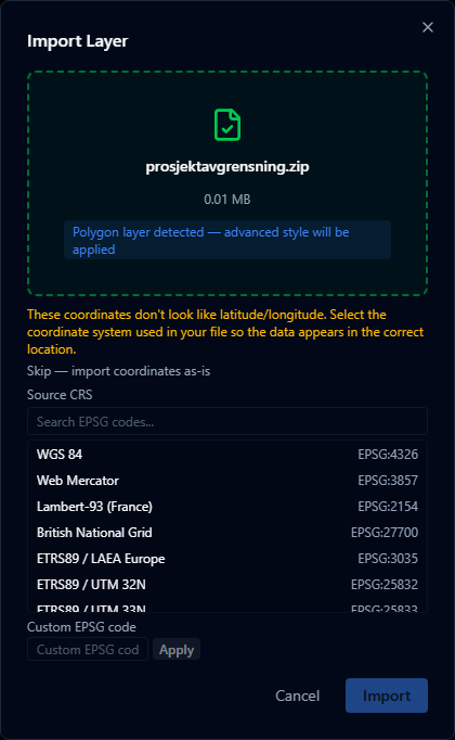
Coordinate systems
AugmentCity reprojects all imported geometries to WGS 84 (EPSG:4326) during import. If your .prj file is missing or uses an unsupported CRS, the import will still succeed but geometry may appear at incorrect locations.
Attribute table
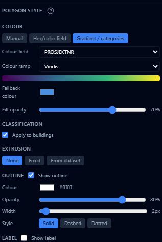
All columns from the .dbf file are imported and available in the Style Editor for color mapping, label display, and height encoding (for 3D bar charts and point markers).
File size limits
The shapefile ZIP must be under 200 MB. For larger datasets, consider splitting by region or simplifying geometry with a tool like Mapshaper.